Worksheets and No Prep Teaching Resources
Reading Comprehension Worksheets
Geography
Countries, States, Cities, and Towns

Geography
Geography


Countries, States, Cities, and Towns
Reading Level
     edHelper's suggested reading level:   grades 3 to 4
     Flesch-Kincaid grade level:   5.43

Vocabulary
     challenging words:    planet, personality, section, schools, outline, divide, bold, lines, coast, amount, flight, government, follow, neighborhood, business, center
     content words:    In North America, United States, Pacific Ocean, New York City


Print Countries, States, Cities, and Towns
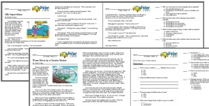
     Print Countries, States, Cities, and Towns  (font options, pick words for additional puzzles, and more)


Quickly Print
     Quickly print reading comprehension


Proofreading Activity
     Print a proofreading activity


Countries, States, Cities, and Towns
By Trista L. Pollard
  

1     Our planet has many places. Most of these places are filled with people. Can you imagine all of the homes, schools, and stores that are on Earth? Geographers do! They study how we use the land that is found on Earth.
 
2     We divide our land into smaller areas. The largest areas of land are continents. We divide the continents into smaller areas called countries, states, towns, and cities. Countries or nations are large land areas that have boundaries. On a political map we see these boundaries. They outline the areas that belong to each country. These boundaries are also made by us. Governments or the people who make laws decide where the boundaries should be for their country. Before you look out of the window on your next plane flight, there is something you should know. You won't see these lines on land. You will only find boundary lines on a map. Country boundaries are usually bold black lines that have dashes.


There are many countries that make up the continent of North America. The largest countries are the United States of America (U.S.A.), Canada, and Mexico. There are several small countries in Central America, which is south of Mexico. There are also many island nations in the Atlantic Ocean and Caribbean Sea that are part of North America.
 
3     Countries are divided into smaller areas. The U.S.A. is divided into fifty states. States are areas that have their own government. They are outlined by boundaries. States have their own sets of laws. They must also follow the laws of the U.S.A. Two of our states, Alaska and Hawaii, do not touch the other forty-eight states. Canada is between Alaska and the forty-eight contiguous states. Hawaii is located in the Pacific Ocean. When you look at the state boundaries on a map, you may find that the state boundaries are thinner than country boundaries.


Paragraphs 4 to 6:
For the complete story with questions: click here for printable


Weekly Reading Books

          Create Weekly Reading Books

Prepare for an entire week at once!


Feedback on Countries, States, Cities, and Towns
Leave your feedback on Countries, States, Cities, and Towns   (use this link if you found an error in the story)


Geography
             Geography


Copyright © 2018 edHelper